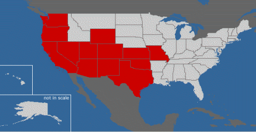
On the Debian Linux blog that I read there is a neat “meme” (see definition here) going around which draws a colored map of the states you have visited in the US. I decided to give it a shot and was surprised about how large a part of my beautiful country I have visited.
The one inaccuracy of this map is that it’s resolution is only state level, so parts of states are colored that I have actually never scene. For example, I have never been to eastern Washington but have visited most of western Washington. I have also only visited the bottom half of Wyoming and the western border of Missouri (Kansas City, Missouri to be specific). It would be an interesting project to create a program to color in the counties within the states that have been visited.
Here is my map of visited states: